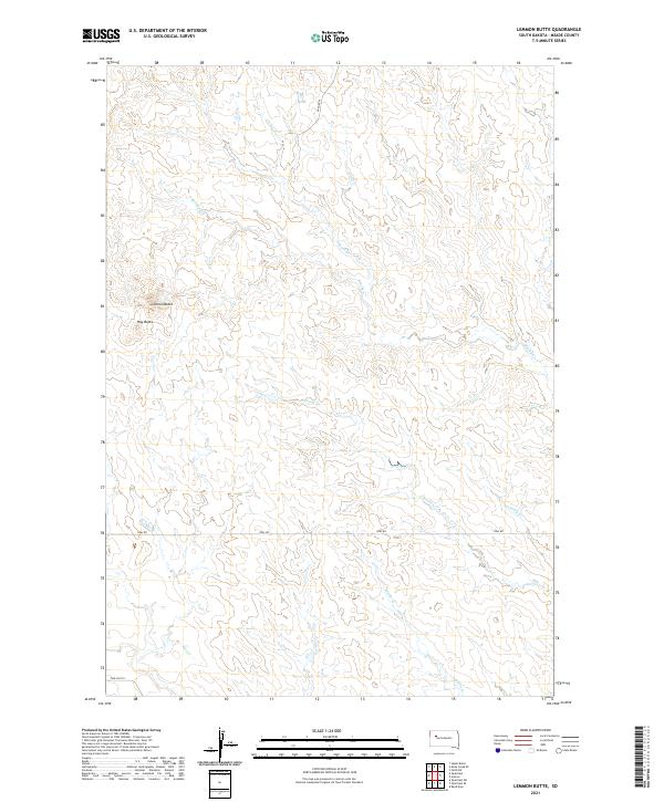
2021 Map of Lemmon Butte
USGS Topo · Published 2021About this map
Lemmon Butte and Hay Butte define the topography of this Meade County landscape, where deep drainages carve through the high plains. The drainage network is particularly dense here, characterized by the winding paths of N Brushy Cr and the main stem of Brushy Cr, which cut across the northern sections. To the south, the water table feeds into Johnny Cr, Jimmy Cr, and Middle Cr, creating a complex system of seasonal or intermittent flow typical of this South Dakota region. Human infrastructure is sparse and largely restricted to a few key thoroughfares such as Opal Rd, which traverses the southern townships. The surveyor's grid, marked by Udager Pl and Twilight Pl, overlays a terrain where the natural elevation of the buttes remains the dominant landmark for navigation.
Find a feature on this map
14 named features on this map. Tap any name to fly to it.
Don’t see what you’re looking for? This feature index may not catch every label — zoom into the map to look around manually.
Map Details
Editions of this 2021 Lemmon Butte Map
This is the sole edition of this map. No revisions or reprints were ever made.
Other maps of this area

1952 · Deep Creek SE
USGS Topo · 1:24,000

1952 · Signal Butte
USGS Topo · 1:24,000

1953 · Rapid City
USGS Topo · 1:250,000

1954 · Lemmon
USGS Topo · 1:250,000

1957 · Lemmon
USGS Topo · 1:250,000

1957 · Rapid City
USGS Topo · 1:250,000

1983 · Lemmon Butte
USGS Topo · 1:24,000
1983 · Avance
USGS Topo · 1:24,000
1983 · Opal East
USGS Topo · 1:24,000

1983 · Opal East SW
USGS Topo · 1:24,000