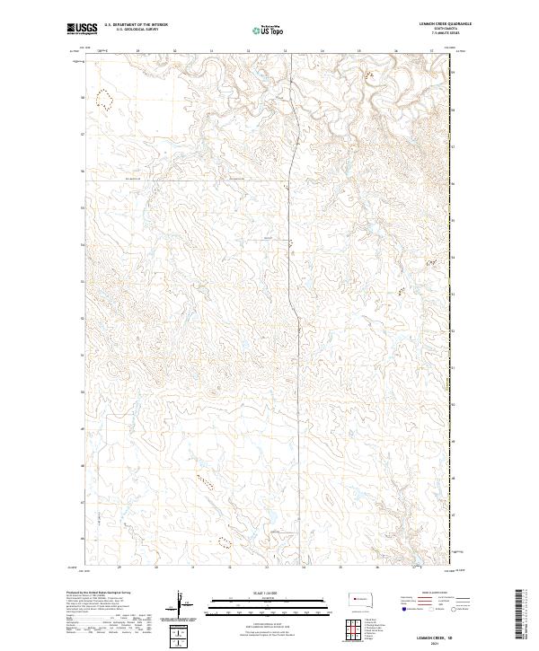
2021 Map of Lemmon Creek
USGS Topo · Published 2021About this map
Lemmon Cr and Cherry Cr carve through the high plains of Meade County, South Dakota, in this modern topographical study. The landscape is defined by an intricate network of seasonal drainages and creek beds, including Johnny Creek and Negro Creek, which underscore the region's complex hydrology. Rural transport is limited to a handful of established routes like Old Marcus Rd, Zeal Rd, and Antelope Rd, which traverse the section lines between townships T9N R16E, T9N R17E, and T8N R17E. This map provides a clear record of the area's physical geography, showing how small tributaries such as Green Berry Cr and Rose Cr help shape the local terrain. The absence of dense settlements highlights the isolated, agricultural character of this portion of the Dakotas.
Find a feature on this map
18 named features on this map. Tap any name to fly to it.
Don’t see what you’re looking for? This feature index may not catch every label — zoom into the map to look around manually.
Map Details
Editions of this 2021 Lemmon Creek Map
This is the sole edition of this map. No revisions or reprints were ever made.
Other maps of this area

1953 · Rapid City
USGS Topo · 1:250,000

1954 · Pierre
USGS Topo · 1:250,000

1955 · Bridger
USGS Topo · 1:24,000

1955 · Howes
USGS Topo · 1:24,000

1957 · Rapid City
USGS Topo · 1:250,000

1958 · Pierre
USGS Topo · 1:250,000

1982 · Chasing Hawk Draw
USGS Topo · 1:24,000

1982 · Dead Horse Draw
USGS Topo · 1:24,000

1983 · Plainview
USGS Topo · 1:24,000
1983 · Avance SE
USGS Topo · 1:24,000