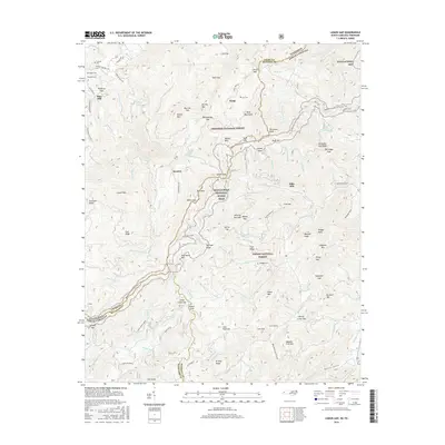
2016 Map of Lemon Gap
USGS Topo · Published 2016About this map
Blue Mill and Ebbs Mill anchor this high-elevation landscape along the border of Tennessee and North Carolina, where the Bald Mountains crest at the divide between Cherokee National Forest and Pisgah National Forest. The map documents a rugged interior network of gaps and coves, with small communities like Wasp and Boomer situated among the winding drainages of Roaring Fork and Panther Br. Genealogists will find a high density of family-named burial sites, including Crowder Cem, Griby Cem, and Waddell Cem, which reflect the localized settlement patterns of the Appalachian highlands. The Appalachian National Scenic Trail traverses the central ridgelines, passing through Lemon Gap and Catpen Gap. This survey captures the persistence of small mountain settlements and the protected wilderness areas that define the modern borderlands of Cocke and Madison counties.
Find a feature on this map
126 named features on this map. Tap any name to fly to it.
Don’t see what you’re looking for? This feature index may not catch every label — zoom into the map to look around manually.
Map Details
Editions of this 2016 Lemon Gap Map
This is the sole edition of this map. No revisions or reprints were ever made.
Other maps of this area

1893 · Mt Guyot
USGS Topo · 1:125,000

1894 · Asheville
USGS Topo · 1:125,000

1901 · Asheville
USGS Topo · 1:125,000

1912 · Mt Guyot
USGS Topo · 1:125,000

1935 · Newport
USGS Topo · 1:48,000

1935 · Paint Rock
USGS Topo · 1:24,000

1935 · Neddy Mountain
USGS Topo · 1:24,000

1935 · Hot Springs
USGS Topo · 1:24,000

1935 · Spring Creek
USGS Topo · 1:24,000

1935 · Lemon Gap
USGS Topo · 1:24,000