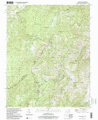
1997 Map of Lemon Gap
USGS Topo · Published 2001About this map
The Appalachian Trail winds along the high ridgelines of the Tennessee North Carolina border, a landscape dominated by the protected acreage of the Cherokee National Forest and Pisgah National Forest. The map centers on the high summit of Max Patch Mtn, a prominent peak that anchors a network of gaps and ridges, including the namesake Lemon Gap and Rattlesnake Gap.
Find a feature on this map
85 named features on this map. Tap any name to fly to it.
Don’t see what you’re looking for? This feature index may not catch every label — zoom into the map to look around manually.
Map Details
Editions of this 1997 Lemon Gap Map
This is the sole edition of this map. No revisions or reprints were ever made.
Other maps of this area

1893 · Mt Guyot
USGS Topo · 1:125,000

1894 · Asheville
USGS Topo · 1:125,000

1901 · Asheville
USGS Topo · 1:125,000

1912 · Mt Guyot
USGS Topo · 1:125,000

1935 · Newport
USGS Topo · 1:48,000

1935 · Paint Rock
USGS Topo · 1:24,000

1935 · Neddy Mountain
USGS Topo · 1:24,000

1935 · Hot Springs
USGS Topo · 1:24,000

1935 · Spring Creek
USGS Topo · 1:24,000

1935 · Lemon Gap
USGS Topo · 1:24,000