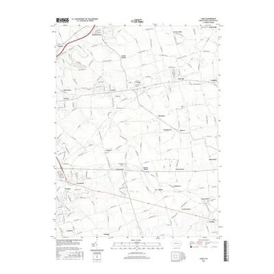
2016 Map of Leola
USGS Topo · Published 2016About this map
Bird in Hand and the adjacent settlement of Intercourse anchor this 2016 survey of central Lancaster County, a region defined by its productive farmland and traditional communities. The map documents a complex network of rural roads such as Groffdale Church Rd and Sheaffers School Rd that weave through the drainages of the Conestoga River and Pequea Creek.
Find a feature on this map
176 named features on this map. Tap any name to fly to it.
Don’t see what you’re looking for? This feature index may not catch every label — zoom into the map to look around manually.
Map Details
Editions of this 2016 Leola Map
This is the sole edition of this map. No revisions or reprints were ever made.
Other maps of this area

1902 · Lancaster
USGS Topo · 1:62,500

1904 · Lancaster
USGS Topo · 1:62,500

1906 · New Holland
USGS Topo · 1:62,500

1908 · New Holland
USGS Topo · 1:62,500

1912 · Quarryville
USGS Topo · 1:62,500

1912 · Mc Calls Ferry
USGS Topo · 1:62,500

1941 · New Holland
USGS Topo · 1:62,500

1943 · Lancaster
USGS Topo · 1:62,500

1943 · Quarryville
USGS Topo · 1:62,500

1943 · Mc Calls Ferry
USGS Topo · 1:62,500
Featured Places
- West Lampeter Township, PA
- Leacock, Upper Leacock Township
- Paradise Township, PA
- Brownstown, West Earl Township
- Upper Leacock Township, PA