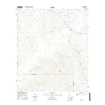
2014 Map of Leon
USGS Topo · Published 2014About this map
Patsaliga Creek meanders across this landscape, serving as the primary drainage for a network of smaller streams like Piney Woods Cr and Mulberry Cr. The settlement of Dozier anchors the southeastern corner, while smaller communities such as Leon and Mulberry are dispersed throughout the rural terrain. This area, straddling the border of Crenshaw and Covington counties, reveals a long history of local land use, from the site of Merrill Mill to the numerous family and community burial grounds such as Leon Cem, Friendship Cem, and Saint Lukes Cem. The map illustrates a developed rural infrastructure of numbered routes like Al-106 and family-named roads, including Holland Bridge Rd and Ball Diamond Ln, which connect the scattered homesteads and local landmarks like Owens Bridge.
Find a feature on this map
65 named features on this map. Tap any name to fly to it.
Don’t see what you’re looking for? This feature index may not catch every label — zoom into the map to look around manually.
Map Details
Editions of this 2014 Leon Map
This is the sole edition of this map. No revisions or reprints were ever made.
Other maps of this area

1953 · Andalusia
USGS Topo · 1:250,000

1957 · Andalusia
USGS Topo · 1:250,000

1971 · Dozier
USGS Topo · 1:24,000

1971 · Industry
USGS Topo · 1:24,000

1971 · Luverne
USGS Topo · 1:24,000

1971 · Brantley
USGS Topo · 1:24,000

1971 · Pigeon Creek
USGS Topo · 1:24,000

1971 · Gantt
USGS Topo · 1:24,000

1971 · Leon
USGS Topo · 1:24,000

1971 · Red Level
USGS Topo · 1:24,000