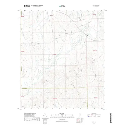
2018 Map of Leon
USGS Topo · Published 2018About this map
Patsaliga Creek meanders across the center of this terrain, serving as the primary hydrological artery for a landscape defined by its creek-fed drainage systems and small rural settlements. In the northern reaches, Mulberry sits near the confluence of Mulberry Cr and Owen Br, while the southeastern corner is anchored by the community of Dozier. The map reveals a high concentration of local family and community heritage sites, including Saint Lukes Cem, Friendship Cem, and Leon Cem. Economic and social infrastructure is marked by features such as Merrill Mill and Owens Bridge, illustrating how the population utilized the various branches and forks, including Piney Woods Cr and Bradley Br, for transport and industry. The winding road network, including Oakey Streak Rd and Mulberry Rd, follows the ridges between the numerous gullies and creek beds.
Find a feature on this map
76 named features on this map. Tap any name to fly to it.
Don’t see what you’re looking for? This feature index may not catch every label — zoom into the map to look around manually.
Map Details
Editions of this 2018 Leon Map
This is the sole edition of this map. No revisions or reprints were ever made.
Other maps of this area

1953 · Andalusia
USGS Topo · 1:250,000

1957 · Andalusia
USGS Topo · 1:250,000

1971 · Dozier
USGS Topo · 1:24,000

1971 · Industry
USGS Topo · 1:24,000

1971 · Luverne
USGS Topo · 1:24,000

1971 · Brantley
USGS Topo · 1:24,000

1971 · Pigeon Creek
USGS Topo · 1:24,000

1971 · Gantt
USGS Topo · 1:24,000

1971 · Leon
USGS Topo · 1:24,000

1971 · Red Level
USGS Topo · 1:24,000