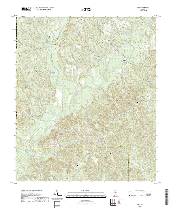
2024 Map of Leon
USGS Topo · Published 2024About this map
Patsaliga Creek and its many tributaries, including Mulberry Creek, define the central landscape of this territory south of Luverne. The map documents a predominantly rural environment where small communities like Mulberry and Leon are interconnected by a dense network of local roads such as Mulberry Rd and Odom Loop Rd. A significant historic landmark, Merrill Mill, sits along the banks of Gin House Creek, suggesting the area's agricultural and processing history.
Find a feature on this map
76 named features on this map. Tap any name to fly to it.
Don’t see what you’re looking for? This feature index may not catch every label — zoom into the map to look around manually.
Map Details
Editions of this 2024 Leon Map
This is the sole edition of this map. No revisions or reprints were ever made.
Other maps of this area

1953 · Andalusia
USGS Topo · 1:250,000

1957 · Andalusia
USGS Topo · 1:250,000

1971 · Dozier
USGS Topo · 1:24,000

1971 · Industry
USGS Topo · 1:24,000

1971 · Luverne
USGS Topo · 1:24,000

1971 · Brantley
USGS Topo · 1:24,000

1971 · Pigeon Creek
USGS Topo · 1:24,000

1971 · Gantt
USGS Topo · 1:24,000

1971 · Leon
USGS Topo · 1:24,000

1971 · Red Level
USGS Topo · 1:24,000