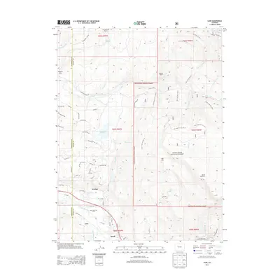
2013 Map of Leon
USGS Topo · Published 2013About this map
The Roaring Fork River valley serves as the focal point for this 2013 topographic study, illustrating the modern residential footprint of El Jebel and Basalt against the expansive backdrop of the White River National Forest. While the southern portion of the map highlights the managed landscape of the Mount Sopris Tree Nursery and the vital water infrastructure of the Home Supply Ditch, the northern and eastern reaches are defined by high-elevation terrain. Dramatic features such as Basalt Mountain and the Cottonwood Divide overlook a network of backcountry routes, including the Lone Tree Trail 1913 and Mill Creek Trail 1937W.1. This map captures the intersection of expanding mountain communities with the protected wilderness of High Park and the canyons carved by Blue Creek and Cattle Creek.
Find a feature on this map
71 named features on this map. Tap any name to fly to it.
Don’t see what you’re looking for? This feature index may not catch every label — zoom into the map to look around manually.
Map Details
Editions of this 2013 Leon Map
This is the sole edition of this map. No revisions or reprints were ever made.
Other maps of this area

1909 · Mount Jackson
USGS Topo · 1:125,000

1911 · Mount Jackson
USGS Topo · 1:125,000

1927 · Glenwood Springs
USGS Topo · 1:125,000

1930 · Glenwood Springs
USGS Topo · 1:125,000

1957 · Leadville
USGS Topo · 1:250,000

1959 · Leadville
USGS Topo · 1:250,000

1960 · Leadville
USGS Topo · 1:250,000

1961 · Mount Sopris
USGS Topo · 1:24,000

1961 · Carbondale
USGS Topo · 1:24,000

1961 · Leon
USGS Topo · 1:24,000