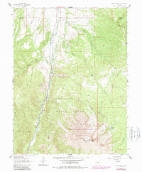
1961 Map of Mount Sopris
USGS Topo · Published 1963About this map
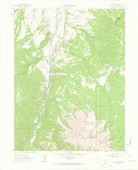
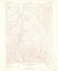
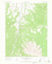
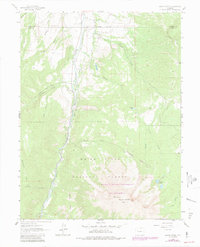
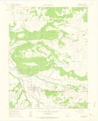
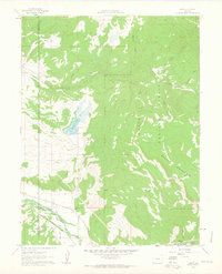
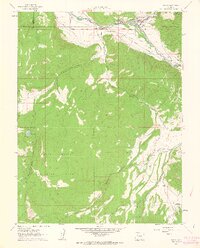
Mount Sopris dominates this 1961 survey, where its steep alpine slopes rise sharply above the Crystal River valley. The landscape is a study in early mountain transit and drainage, characterized by an Old Railroad Grade that winds through the western terrain near Thompson Creek. Much of the quadrangle is preserved within the White River National Forest, showing a network of Pack Trails and Jeep Trails that provided access for early forestry and recreation. The eastern slopes are carved by numerous waterways including Prince Creek and Thomas Creek, the latter of which feeds the high-elevation Thomas Lakes situated just below the primary peaks. Numerous named gulches such as Bowles Gulch and Smith Gulch detail the complex topography of the Garfield and Pitkin county line, while small reservoirs like St John Res indicate historical water management for the valley below.
Find a feature on this map
23 named features on this map. Tap any name to fly to it.
Don’t see what you’re looking for? This feature index may not catch every label — zoom into the map to look around manually.
Map Details
Editions of this 1961 Mount Sopris Map
5 editions found
Other maps of this area

1957 · Leadville
USGS Topo · 1:250,000

1959 · Leadville
USGS Topo · 1:250,000

1960 · Leadville
USGS Topo · 1:250,000
1960 · Capitol Peak
USGS Topo · 1:24,000
1960 · Redstone
USGS Topo · 1:24,000
1961 · Cattle Creek
USGS Topo · 1:24,000
1961 · Carbondale
USGS Topo · 1:24,000
1961 · Leon
USGS Topo · 1:24,000
1961 · Basalt
USGS Topo · 1:24,000

1962 · Leadville
USGS Topo · 1:250,000