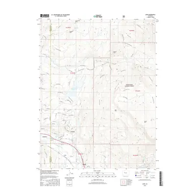
2016 Map of Leon
USGS Topo · Published 2016About this map
Basalt Mountain dominates the eastern half of this landscape, its slopes crisscrossed by the Mill Creek Rim Trail and the Blue Creek Trail within the White River National Forest. The topography drops sharply into the valley of the Roaring Fork River, where the town of Basalt and the community of El Jebel are established. This 2016 survey shows the intricate water management required in this high-altitude environment, from the Home Supply Ditch to high basins containing McNulty Reservoir and Spring Park Reservoir. To the west, the Garfield and Eagle county line bisects the high ground of the Cottonwood Divide. The map detail traces the evolution of these mountain settlements, including the site of Leon along Hooks Spur Rd and the crossroads at Catherine.
Find a feature on this map
94 named features on this map. Tap any name to fly to it.
Don’t see what you’re looking for? This feature index may not catch every label — zoom into the map to look around manually.
Map Details
Editions of this 2016 Leon Map
This is the sole edition of this map. No revisions or reprints were ever made.
Other maps of this area

1909 · Mount Jackson
USGS Topo · 1:125,000

1911 · Mount Jackson
USGS Topo · 1:125,000

1927 · Glenwood Springs
USGS Topo · 1:125,000

1930 · Glenwood Springs
USGS Topo · 1:125,000

1957 · Leadville
USGS Topo · 1:250,000

1959 · Leadville
USGS Topo · 1:250,000

1960 · Leadville
USGS Topo · 1:250,000

1961 · Mount Sopris
USGS Topo · 1:24,000

1961 · Carbondale
USGS Topo · 1:24,000

1961 · Leon
USGS Topo · 1:24,000