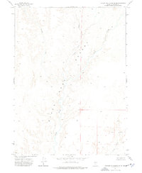
1972 Map of Leonard Cr. Slough South
USGS Topo · Published 1977About this map
The Black Rock Desert defines the landscape of this 1970s survey, showing a vast arid expanse where water is transient and precious. The Quinn River meanders through the desert floor, its channel flanked by the Leonard Creek Slough and Jackson Creek Slough. These drainage features represent the vital hydrological network of northern Nevada, where seasonal flows dictate the movement of water across the alkaline flats. The map documents the precise topography of the desert basin, recording the subtle shifts in elevation that guide these intermittent waterways through Humboldt County. It serves as a detailed record of this unpopulated region, highlighting the natural watercourses that have historically supported ranching and migration in the Great Basin.
Find a feature on this map
5 named features on this map. Tap any name to fly to it.
Don’t see what you’re looking for? This feature index may not catch every label — zoom into the map to look around manually.
Map Details
Editions of this 1972 Leonard Cr. Slough South Map
This is the sole edition of this map. No revisions or reprints were ever made.
Other maps of this area

1886 · Disaster
USGS Topo · 1:250,000

1893 · Disaster
USGS Topo · 1:250,000

1954 · Vya
USGS Topo · 1:250,000

1958 · Vya
USGS Topo · 1:250,000

1962 · Vya
USGS Topo · 1:250,000

1966 · King Lear Peak
USGS Topo · 1:62,500

1972 · Deer Creek Slough
USGS Topo · 1:24,000

1972 · Pinto Mountain
USGS Topo · 1:24,000

1972 · Hobo Canyon
USGS Topo · 1:24,000

1972 · Leonard Cr. Slough North
USGS Topo · 1:24,000