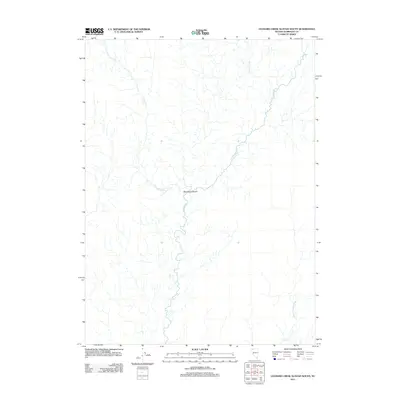
2011 Map of Leonard Creek Slough South
USGS Topo · Published 2011About this map
Black Rock Desert terrain defines this portion of Humboldt County, where the desert floor meets a complex network of ephemeral watercourses. The Quinn River meanders prominently through the center of the sheet, illustrating the drainage patterns of this arid basin. Tributaries such as Leonard Creek and Sentinel Creek descend toward the valley floor, feeding into the wider hydrological system that includes the Jackson Creek Slough. This 2011 survey captures the landscape as it existed before recent shifts in land use, showing the stark, open character of the high desert and the vital importance of these seasonal waterways to the local environment and historical cattle ranching operations in the region.
Find a feature on this map
5 named features on this map. Tap any name to fly to it.
Don’t see what you’re looking for? This feature index may not catch every label — zoom into the map to look around manually.
Map Details
Editions of this 2011 Leonard Creek Slough South Map
This is the sole edition of this map. No revisions or reprints were ever made.
Other maps of this area

1886 · Disaster
USGS Topo · 1:250,000

1893 · Disaster
USGS Topo · 1:250,000

1954 · Vya
USGS Topo · 1:250,000

1958 · Vya
USGS Topo · 1:250,000

1962 · Vya
USGS Topo · 1:250,000

1966 · King Lear Peak
USGS Topo · 1:62,500

1972 · Deer Creek Slough
USGS Topo · 1:24,000

1972 · Pinto Mountain
USGS Topo · 1:24,000

1972 · Hobo Canyon
USGS Topo · 1:24,000

1972 · Leonard Cr. Slough North
USGS Topo · 1:24,000