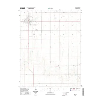
2015 Map of Leoti
USGS Topo · Published 2015About this map
The High Plains of Wichita County are centered on Leoti, where a dense residential grid of streets like Broadway St and Logan St meets the agricultural expanse. To the east, the settlement of Coronado sits along the road network that defines the region's rectilinear land management. The terrain is marked by seasonal drainages including White Woman Cr to the southwest and Rocky Draw in the northeast, providing rare relief in the flat prairie landscape. Aviation and local history intersect at the Mark Hoard Memorial Airport south of town, while the Leoti Cem serves as a primary genealogical landmark for the community. The map illustrates the transition from organized town blocks to the vast open sections of the surrounding township, connected by a systematic series of county roads such as Co Rd 13 and Co Rd 15.
Find a feature on this map
49 named features on this map. Tap any name to fly to it.
Don’t see what you’re looking for? This feature index may not catch every label — zoom into the map to look around manually.
Map Details
Editions of this 2015 Leoti Map
This is the sole edition of this map. No revisions or reprints were ever made.
Other maps of this area

1939 · Pence
USGS Topo · 1:62,500

1941 · Modoc
USGS Topo · 1:62,500

1941 · Pence
USGS Topo · 1:62,500

1951 · Modoc
USGS Topo · 1:62,500

1955 · Scott City
USGS Topo · 1:250,000

1958 · Scott City
USGS Topo · 1:250,000

1968 · Russell Springs 3 SW
USGS Topo · 1:24,000

1968 · Russell Springs 3 SE
USGS Topo · 1:24,000

1970 · Leoti
USGS Topo · 1:24,000

1970 · Lydia
USGS Topo · 1:24,000