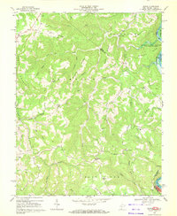
1968 Map of Lerona
USGS Topo · Published 1972About this map
Lerona and Elgood sit atop a landscape defined by high ridges and the deep incision of the New River at the eastern edge of Mercer County. In the late 1960s, the rural character of the area is evidenced by the concentration of family and community institutions, including Sun Valley Sch and several small houses of worship like Sun Rise Chapel, Whites Chapel, and Thompson Chapel.
Find a feature on this map
50 named features on this map. Tap any name to fly to it.
Don’t see what you’re looking for? This feature index may not catch every label — zoom into the map to look around manually.
Map Details
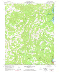
Editions of this 1968 Lerona Map
2 editions found
Other maps of this area

1887 · Pocahontas
USGS Topo · 1:125,000

1887 · Hinton
USGS Topo · 1:125,000

1890 · Dublin
USGS Topo · 1:125,000

1891 · Pocahontas
USGS Topo · 1:125,000

1891 · Dublin
USGS Topo · 1:125,000

1891 · Raleigh
USGS Topo · 1:125,000

1892 · Hinton
USGS Topo · 1:125,000

1894 · Pocahontas
USGS Topo · 1:125,000

1895 · Pocahontas
USGS Topo · 1:125,000

1897 · Raleigh
USGS Topo · 1:125,000