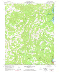
1968 Map of Lerona
USGS Topo · Published 1977About this map
Bent Mountain and Browns Ridge dominate this rugged section of Mercer County, West Virginia, as it appeared in the late 1960s. The landscape is defined by its deep drainages, including Dry Fork, Lick Creek, and Island Creek, all feeding toward the New River at the eastern boundary. This area shows a dispersed pattern of small rural communities and mountain gaps, with Lerona situated in the north and Elgood to the south.
Find a feature on this map
43 named features on this map. Tap any name to fly to it.
Don’t see what you’re looking for? This feature index may not catch every label — zoom into the map to look around manually.
Map Details
Editions of this 1968 Lerona Map
2 editions found
Other maps of this area

1887 · Pocahontas
USGS Topo · 1:125,000

1887 · Hinton
USGS Topo · 1:125,000

1890 · Dublin
USGS Topo · 1:125,000

1891 · Pocahontas
USGS Topo · 1:125,000

1891 · Dublin
USGS Topo · 1:125,000

1891 · Raleigh
USGS Topo · 1:125,000

1892 · Hinton
USGS Topo · 1:125,000

1894 · Pocahontas
USGS Topo · 1:125,000

1895 · Pocahontas
USGS Topo · 1:125,000

1897 · Raleigh
USGS Topo · 1:125,000