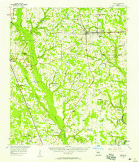
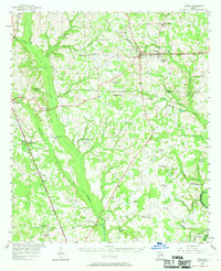
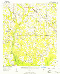
1956 Map of Leslie
USGS Topo · Published 1958About this map
The agricultural landscape of Sumter and Lee Counties in the mid-1950s is defined by a dense network of rural churches and schoolhouses. Small settlements like Leslie and DeSoto serve as hubs along the Seaboard Air Line railroad, while Smithville marks a significant junction point for the Central of Georgia line. These rail corridors, alongside the Albany and Northern, provided the essential infrastructure for the region's transport economy before the widespread expansion of modern highways.
Find a feature on this map
57 named features on this map. Tap any name to fly to it.
Don’t see what you’re looking for? This feature index may not catch every label — zoom into the map to look around manually.
Map Details
Editions of this 1956 Leslie Map
2 editions found
Other maps of this area

1953 · Dothan
USGS Topo · 1:250,000

1953 · Waycross
USGS Topo · 1:250,000

1954 · Dothan
USGS Topo · 1:250,000

1955 · Dothan
USGS Topo · 1:250,000

1955 · Phenix City
USGS Topo · 1:250,000

1956 · Sylvester
USGS Topo · 1:62,500
1956 · Sasser
USGS Topo · 1:62,500

1956 · Albany
USGS Topo · 1:62,500

1957 · Phenix City
USGS Topo · 1:250,000

1957 · Macon
USGS Topo · 1:250,000