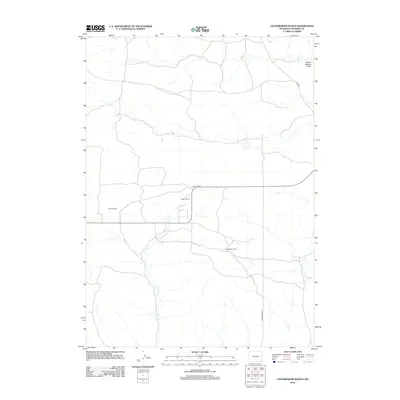
2012 Map of Leuenberger Ranch
USGS Topo · Published 2012About this map
High plains ranching life in Wyoming's Converse County is the focus of this 2012 survey. Named holdings like the Leuenberger Ranch and Keenan Ranch define the settlement pattern, where large-scale land use depends on seasonal drainage. The landscape is carved by watercourses such as Little Sand Cr and Sage Cr, which have shaped the topography of the region. Local navigation relies on established thoroughfares like Ross Rd and Leuenberger Ln, which connect these isolated homesteads. The presence of School Section Draw in the northeast corner highlights the historical distribution of public land set aside for education. For those tracing regional agricultural history, the map provides precise locations for the Negley Ranch and Layton Ranch during the early 21st century.
Find a feature on this map
9 named features on this map. Tap any name to fly to it.
Don’t see what you’re looking for? This feature index may not catch every label — zoom into the map to look around manually.
Map Details
Editions of this 2012 Leuenberger Ranch Map
This is the sole edition of this map. No revisions or reprints were ever made.
Other maps of this area

1949 · Orpha
USGS Topo · 1:24,000

1949 · Careyhurst
USGS Topo · 1:24,000

1949 · Gilbert Lake
USGS Topo · 1:24,000

1949 · Glenrock
USGS Topo · 1:24,000

1949 · Leuenberger Ranch
USGS Topo · 1:24,000

1949 · Hylton Ranch
USGS Topo · 1:24,000

1950 · Careyhurst
USGS Topo · 1:24,000

1950 · Gilbert Lake
USGS Topo · 1:24,000

1950 · Leuenberger Ranch
USGS Topo · 1:24,000

1950 · Orpha
USGS Topo · 1:24,000