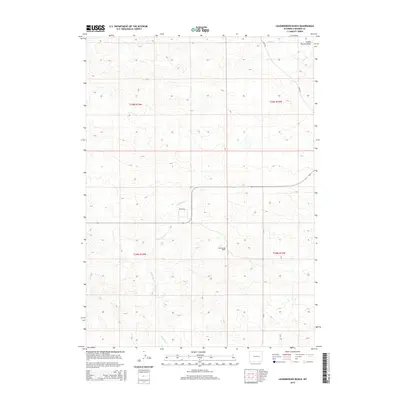
2015 Map of Leuenberger Ranch
USGS Topo · Published 2015About this map
Leuenberger Ranch serves as a central landmark in this portion of the Powder River Basin, illustrating the persistent ranching legacy of Converse County in the mid-2010s. The landscape is defined by its drainage systems, including the northeast-flowing Sage Cr and the winding course of Little Sand Cr. These waterways, along with the distinctively named School Section Draw, dictate the movement of livestock and the placement of rural infrastructure across the high plains. A grid of local thoroughfares like Ross Rd, Negley Rd, and Cr-26 provides the essential framework for navigating the expansive private holdings and public lands. This survey documents the intersection of modern road networks with traditional western land use, highlighting how topographic features continue to shape the footprint of Wyoming ranching operations.
Find a feature on this map
11 named features on this map. Tap any name to fly to it.
Don’t see what you’re looking for? This feature index may not catch every label — zoom into the map to look around manually.
Map Details
Editions of this 2015 Leuenberger Ranch Map
This is the sole edition of this map. No revisions or reprints were ever made.
Other maps of this area

1949 · Orpha
USGS Topo · 1:24,000

1949 · Careyhurst
USGS Topo · 1:24,000

1949 · Gilbert Lake
USGS Topo · 1:24,000

1949 · Glenrock
USGS Topo · 1:24,000

1949 · Leuenberger Ranch
USGS Topo · 1:24,000

1949 · Hylton Ranch
USGS Topo · 1:24,000

1950 · Careyhurst
USGS Topo · 1:24,000

1950 · Gilbert Lake
USGS Topo · 1:24,000

1950 · Leuenberger Ranch
USGS Topo · 1:24,000

1950 · Orpha
USGS Topo · 1:24,000