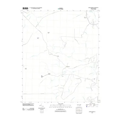
2010 Map of Lewis Swamp
USGS Topo · Published 2010About this map
Lewis Swamp and the surrounding coastal plain of Brunswick County define this landscape, where a network of watercourses like Town Creek and Tompkin Branch weave through a patchwork of ridges and lowlands. Local settlements and family-named landmarks are scattered throughout the quadrangle, including Rabontown, Batarora, and the Old Cumbee Place. The terrain is characterized by subtle elevation changes across Gapway Ridge and Big Bay Ridge, while Modes Island stands out within the swampy interior. The road network, featuring routes such as Town Creek Rd NE and Green Hill Rd NE, connects isolated rural corners like Brier Patch and Flowers Corner. This topographic study captures the drainage patterns and rural property divisions of the North Carolina tidewater region at the start of the 21st century.
Find a feature on this map
46 named features on this map. Tap any name to fly to it.
Don’t see what you’re looking for? This feature index may not catch every label — zoom into the map to look around manually.
Map Details
Editions of this 2010 Lewis Swamp Map
This is the sole edition of this map. No revisions or reprints were ever made.
Other maps of this area

1943 · Funston
USGS Topo · 1:24,000

1943 · Honey Island
USGS Topo · 1:24,000

1943 · Winnabow
USGS Topo · 1:24,000

1943 · Bolivia
USGS Topo · 1:24,000

1943 · Supply
USGS Topo · 1:24,000

1943 · Lewis Swamp
USGS Topo · 1:24,000

1944 · Supply
USGS Topo · 1:31,680

1944 · Bolivia
USGS Topo · 1:31,680

1944 · Winnabow
USGS Topo · 1:31,680

1944 · Lewis Swamp
USGS Topo · 1:31,680