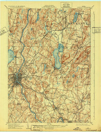
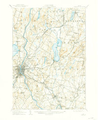
1908 Map of Lewiston
USGS Topo · Published 1932About this map
The Androscoggin River serves as the industrial and geographic spine of this Maine landscape, powering the twin cities and connecting a network of mill towns and rural corners. In the urban center, Bates College and the State Fairgrounds appear as established landmarks, while the City Farm reflects early 20th-century social infrastructure. The map reveals a dense transportation web including the Maine Central RR and the Lewiston and Brunswick Electric RR, which facilitated movement between manufacturing hubs like Lisbon Falls and the agricultural hinterlands.
Find a feature on this map
126 named features on this map. Tap any name to fly to it.
Don’t see what you’re looking for? This feature index may not catch every label — zoom into the map to look around manually.
Map Details
Editions of this 1908 Lewiston Map
6 editions found
Other maps of this area

1892 · Gardiner
USGS Topo · 1:62,500

1892 · Freeport
USGS Topo · 1:62,500

1892 · Augusta
USGS Topo · 1:62,500

1894 · Gray
USGS Topo · 1:62,500

1894 · Bath
USGS Topo · 1:62,500

1898 · Gray
USGS Topo · 1:62,500

1908 · Poland
USGS Topo · 1:62,500

1908 · Lewiston
USGS Topo · 1:62,500

1910 · Livermore
USGS Topo · 1:62,500

1911 · Buckfield
USGS Topo · 1:62,500