
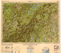
1950 Map of Lewiston
USGS Topo · Published 1950About this map
The industrial centers of Lewiston and Auburn anchor the southeastern corner of this mid-century survey, while the massive expanse of the White Mountain National Forest dominates the west. The landscape is defined by the high peaks of the Presidential Range, including Mount Washington, Mount Adams, and Mount Jefferson. The regional economy of the 1950s is reflected in the dense network of water and rail, with the Androscoggin River winding through mill towns like Rumford and Mexico.
Find a feature on this map
402 named features on this map. Tap any name to fly to it.
Don’t see what you’re looking for? This feature index may not catch every label — zoom into the map to look around manually.
Map Details
Editions of this 1950 Lewiston Map
2 editions found
Other maps of this area

1892 · Gardiner
USGS Topo · 1:62,500

1892 · Freeport
USGS Topo · 1:62,500

1892 · Augusta
USGS Topo · 1:62,500

1893 · Mt. Washington
USGS Topo · 1:62,500

1893 · Gorham
USGS Topo · 1:62,500

1894 · Norridgewock
USGS Topo · 1:62,500

1894 · North Conway
USGS Topo · 1:62,500

1894 · Gray
USGS Topo · 1:62,500

1894 · Bath
USGS Topo · 1:62,500

1895 · Crawford Notch
USGS Topo · 1:62,500