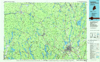
1986 Map of Lewiston
USGS Topo · Published 1986About this map
The industrial and transportation heart of south-central Maine is anchored by the twin cities of Lewiston and Auburn, situated along the power-generating falls of the Androscoggin River. In the mid-1980s, the region’s landscape was defined by its transition from the densely populated river valley to the wooded peaks of the White Mountain National Forest to the west. Transit corridors such as the Maine Central Railroad and the Canadian National Railway connected manufacturing centers like Lisbon Falls, Mechanic Falls, and Rumford to broader markets. Beyond the industrial centers, the map reveals a lake-rich interior including Sebago Lake, Long Lake, and Thompson Lake, illustrating the area's dual character as both a mill-driven economy and a recreational gateway. To the northwest, peaks like Old Speck Mountain and Mount Abram rise sharply, while smaller communities like Norway and South Paris serve as local hubs for the surrounding hill country and agricultural lands.
Find a feature on this map
201 named features on this map. Tap any name to fly to it.
Don’t see what you’re looking for? This feature index may not catch every label — zoom into the map to look around manually.
Map Details
Editions of this 1986 Lewiston Map
2 editions found
Other maps of this area

1892 · Gardiner
USGS Topo · 1:62,500

1892 · Freeport
USGS Topo · 1:62,500

1892 · Augusta
USGS Topo · 1:62,500

1893 · Gorham
USGS Topo · 1:62,500

1894 · Norridgewock
USGS Topo · 1:62,500

1894 · North Conway
USGS Topo · 1:62,500

1894 · Gray
USGS Topo · 1:62,500

1894 · Bath
USGS Topo · 1:62,500

1896 · Norway
USGS Topo · 1:62,500

1896 · Sebago
USGS Topo · 1:62,500