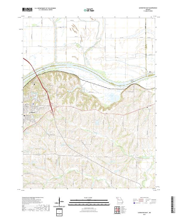
2021 Map of Lexington East
USGS Topo · Published 2021About this map
Lexington serves as the focal point for this section of Lafayette County, where the landscape is defined by the sharp northern turn of the Missouri River. The river's winding path creates prominent geographic features like Lexington Bend, Sheep Nose Bend, and Tabo Bend, while the confluence with the Crooked River marks the northern border with Ray County. The town's local history and community roots are well-documented through several established sites, including Machpelah Cem and Jubilee University.
Find a feature on this map
71 named features on this map. Tap any name to fly to it.
Don’t see what you’re looking for? This feature index may not catch every label — zoom into the map to look around manually.
Map Details
Editions of this 2021 Lexington East Map
This is the sole edition of this map. No revisions or reprints were ever made.
Other maps of this area

1889 · Lexington
USGS Topo · 1:125,000

1949 · Mayview
USGS Topo · 1:24,000

1949 · Lexington East
USGS Topo · 1:24,000

1949 · Lexington West
USGS Topo · 1:24,000

1949 · Odessa North
USGS Topo · 1:24,000

1950 · Lexington East
USGS Topo · 1:24,000

1950 · Mayview
USGS Topo · 1:24,000

1950 · Odessa North
USGS Topo · 1:24,000
1950 · Lexington West
USGS Topo · 1:24,000

1950 · Dover
USGS Topo · 1:24,000