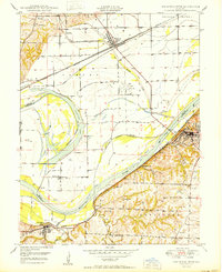
1950 Map of Lexington West
USGS Topo · Published 1965About this map
The Missouri River corridor near the Ray Co Lafayette Co boundary highlights a landscape shaped by river engineering and early industrial activity. Just after mid-century, the area between Lexington and Wellington shows a complex system of Levees and a Flood Gate protecting the lowlands, including the distinctive crescent of Sunshine Lake. This environment supported a variety of coal-related work, evidenced by numerous Mine Dumps and a Mine Dump scattered across the bluffs near Myrick.
Find a feature on this map
34 named features on this map. Tap any name to fly to it.
Don’t see what you’re looking for? This feature index may not catch every label — zoom into the map to look around manually.
Map Details
Editions of this 1950 Lexington West Map
This is the sole edition of this map. No revisions or reprints were ever made.
Other maps of this area

1889 · Lexington
USGS Topo · 1:125,000

1894 · Independence
USGS Topo · 1:125,000

1949 · Mayview
USGS Topo · 1:24,000

1949 · Lexington East
USGS Topo · 1:24,000

1949 · Lexington West
USGS Topo · 1:24,000

1949 · Odessa North
USGS Topo · 1:24,000

1950 · Lexington East
USGS Topo · 1:24,000

1950 · Mayview
USGS Topo · 1:24,000

1950 · Kansas City
USGS Topo · 1:250,000

1950 · Odessa North
USGS Topo · 1:24,000