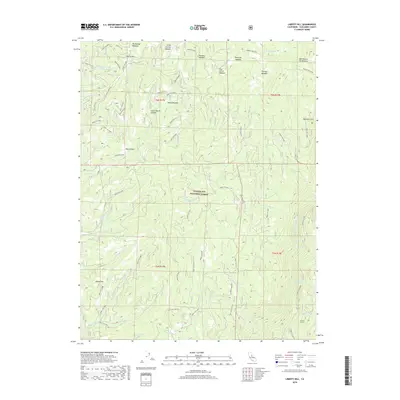
2018 Map of Liberty Hill
USGS Topo · Published 2018About this map
Stanislaus National Forest defines this high-elevation landscape in Tuolumne County, where the topography is shaped by the Middle Fork Stanislaus River and its numerous tributaries. The map reveals a high-country network of meadow systems, such as Big Prather Meadow, Shoofly Meadow, and Post Corral Meadow, which historically served as vital landmarks for grazing and early forest travel. Notable landforms like Liberty Hill and the Whittakers Dardanelles provide distinct vertical relief above deep drainage basins including Blue Canyon and Little Beaver Canyon. This modern forest survey documents the complex infrastructure of Forest Service routes, such as Forest Rte 6N29 and Forest Rte 5N14, alongside industrial artifacts like the Donnell Tunnel and named flats like Bummers Flat.
Find a feature on this map
63 named features on this map. Tap any name to fly to it.
Don’t see what you’re looking for? This feature index may not catch every label — zoom into the map to look around manually.
Map Details
Editions of this 2018 Liberty Hill Map
This is the sole edition of this map. No revisions or reprints were ever made.
Other maps of this area

1891 · Big Trees
USGS Topo · 1:125,000

1894 · Big Trees
USGS Topo · 1:125,000

1896 · Dardanelles
USGS Topo · 1:125,000

1897 · Big Trees
USGS Topo · 1:125,000

1898 · Dardanelles
USGS Topo · 1:125,000

1901 · Big Trees
USGS Topo · 1:125,000

1947 · Sacramento
USGS Topo · 1:250,000

1948 · Walker Lake
USGS Topo · 1:250,000

1948 · Sacramento
USGS Topo · 1:250,000

1956 · Sacramento
USGS Topo · 1:250,000