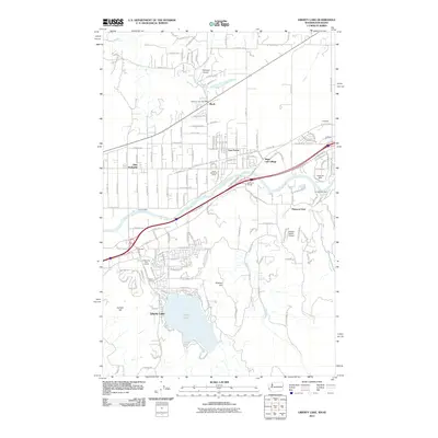
2011 Map of Liberty Lake
USGS Topo · Published 2011About this map
Spokane River flows across the Idaho and Washington border, serving as the central axis for this 2011 survey of the valley between Post Falls and Spokane. Residential expansion is evident in the clusters of Otis Orchards, Aturdee, and Mulsh Grove, while the lake itself, Liberty Lake, remains a prominent natural feature to the south. The landscape is marked by unique historical and recreational landmarks, from the Valley View Golf Course to the curiously named Horse Slaughter Camp and Spokane Bridge.
Find a feature on this map
62 named features on this map. Tap any name to fly to it.
Don’t see what you’re looking for? This feature index may not catch every label — zoom into the map to look around manually.
Map Details
Editions of this 2011 Liberty Lake Map
This is the sole edition of this map. No revisions or reprints were ever made.
Other maps of this area

1901 · Spokane
USGS Topo · 1:125,000

1903 · Rathdrum
USGS Topo · 1:125,000

1943 · Mt Spokane
USGS Topo · 1:62,500

1949 · Greenacres
USGS Topo · 1:62,500

1950 · Mt Spokane
USGS Topo · 1:62,500

1951 · Greenacres
USGS Topo · 1:62,500

1955 · Spokane
USGS Topo · 1:250,000

1957 · Coeur D'Alene
USGS Topo · 1:62,500

1958 · Spokane
USGS Topo · 1:250,000

1961 · Rathdrum
USGS Topo · 1:24,000