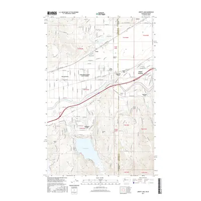
2017 Map of Liberty Lake
USGS Topo · Published 2017About this map
Liberty Lake sits at the heart of this landscape, its waters framed by the rising elevations of Kramer Hill and Carlson Hill. This 2017 study illustrates the complex residential and transportation corridors bridging the Washington-Idaho state line. The Spokane River flows through a series of communities that have merged into a continuous suburban landscape, from Spokane Valley and Otis Orchards-East Farms in the west to Post Falls across the border.
Find a feature on this map
86 named features on this map. Tap any name to fly to it.
Don’t see what you’re looking for? This feature index may not catch every label — zoom into the map to look around manually.
Map Details
Editions of this 2017 Liberty Lake Map
This is the sole edition of this map. No revisions or reprints were ever made.
Other maps of this area

1901 · Spokane
USGS Topo · 1:125,000

1903 · Rathdrum
USGS Topo · 1:125,000

1943 · Mt Spokane
USGS Topo · 1:62,500

1949 · Greenacres
USGS Topo · 1:62,500

1950 · Mt Spokane
USGS Topo · 1:62,500

1951 · Greenacres
USGS Topo · 1:62,500

1955 · Spokane
USGS Topo · 1:250,000

1957 · Coeur D'Alene
USGS Topo · 1:62,500

1958 · Spokane
USGS Topo · 1:250,000

1961 · Rathdrum
USGS Topo · 1:24,000