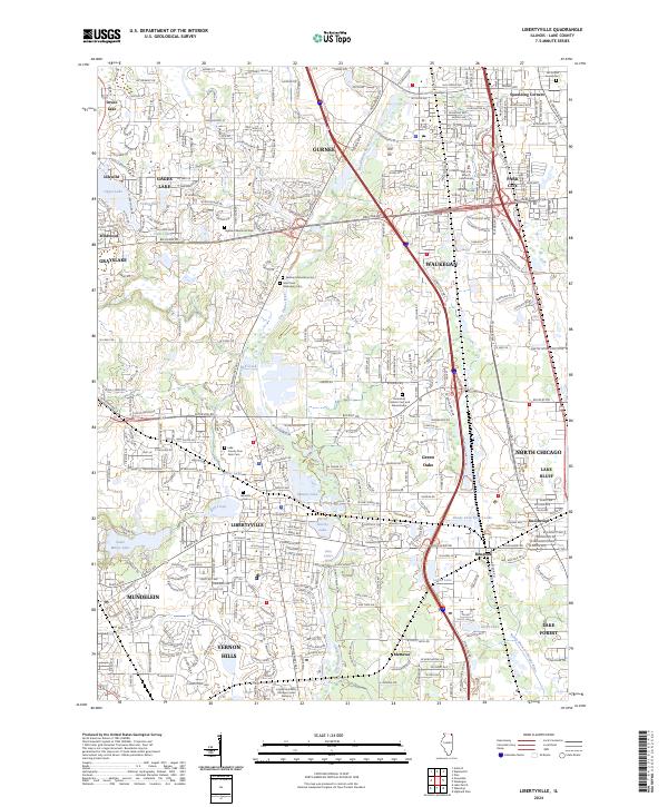
2024 Map of Libertyville
USGS Topo · Published 2024About this map
The Des Plaines River corridor anchors this modern landscape in Lake County, where dense suburban development meets significant cultural and historical sites. The area is characterized by a high concentration of religious and memorial grounds, notably the Saint Sava Monastery Cem and Serbian Monastery Cem, which reflect the region's diverse heritage. To the north, Gurnee and Waukegan show extensive residential and commercial expansion, while the presence of the County Poor Farm Cem near Libertyville offers a tangible connection to the early social history and institutional care of the county.
Find a feature on this map
285 named features on this map. Tap any name to fly to it.
Don’t see what you’re looking for? This feature index may not catch every label — zoom into the map to look around manually.
Map Details
Editions of this 2024 Libertyville Map
This is the sole edition of this map. No revisions or reprints were ever made.
Historical Maps of Idlewild Through Time
4 maps found