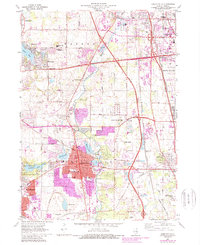
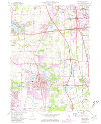
1960 Map of Libertyville
USGS Topo · Published 1989About this map
Libertyville and its surrounding Lake County neighbors appear at a moment of significant mid-century suburban expansion, evidenced by the extensive purple-tinted updates from the 1970s. The Des Plaines River winds centrally through the landscape, flanked by a dense concentration of religious and educational institutions. Of particular note are the expansive grounds of St Marys of the Lake Seminary and the nearby Benedictine Convent and St Sava Monastery.
Find a feature on this map
60 named features on this map. Tap any name to fly to it.
Don’t see what you’re looking for? This feature index may not catch every label — zoom into the map to look around manually.
Map Details
Editions of this 1960 Libertyville Map
5 editions found
Other maps of this area

1900 · Highwood
USGS Topo · 1:62,500

1906 · Waukegan
USGS Topo · 1:62,500

1908 · Waukegan
USGS Topo · 1:62,500

1920 · Grays Lake
USGS Topo · 1:62,500

1923 · Grays Lake
USGS Topo · 1:62,500

1923 · Barrington
USGS Topo · 1:62,500

1928 · Wheeling
USGS Topo · 1:24,000

1928 · Highland Park
USGS Topo · 1:24,000

1935 · Barrington
USGS Topo · 1:62,500

1951 · Highland Park
USGS Topo · 1:24,000