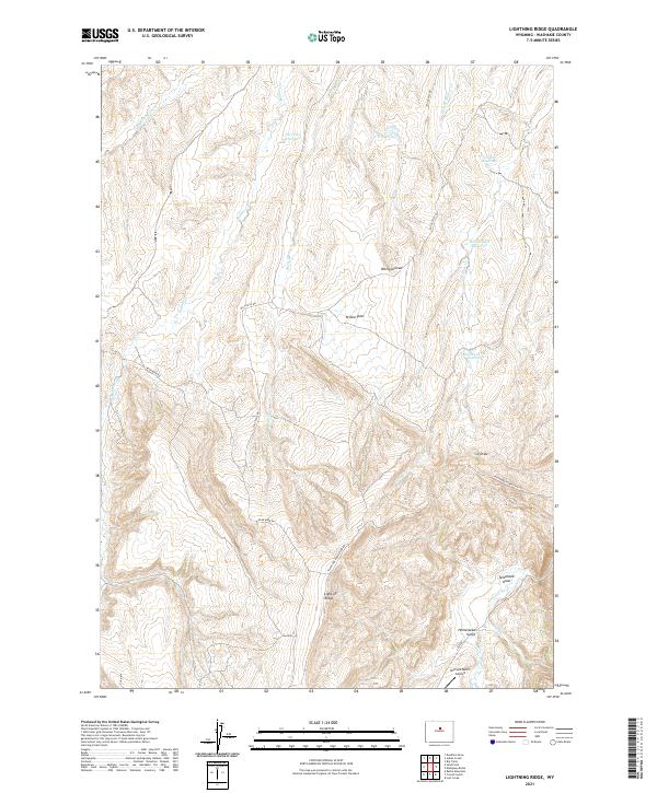
2021 Map of Lightning Ridge
USGS Topo · Published 2021About this map
Lightning Ridge rises above a high-desert landscape in Washakie County, where a network of seasonal draws and creeks feeds the Nowood River in the southeast. This modern survey illustrates the enduring patterns of ranching infrastructure, characterized by remote water management sites like Two Tree Reservoir, C C Reservoir, and Round Corral Reservoir. The terrain is marked by named geographic features such as Yellow Flats and Werland Draw, which provide clues to historical land use and early surveying points.
Find a feature on this map
29 named features on this map. Tap any name to fly to it.
Don’t see what you’re looking for? This feature index may not catch every label — zoom into the map to look around manually.
Map Details
Editions of this 2021 Lightning Ridge Map
This is the sole edition of this map. No revisions or reprints were ever made.
Other maps of this area

1952 · Battle Mountain
USGS Topo · 1:24,000

1955 · Arminto
USGS Topo · 1:250,000

1958 · Arminto
USGS Topo · 1:250,000

1962 · Arminto
USGS Topo · 1:250,000

1966 · Big Trails
USGS Topo · 1:24,000

1966 · Deadline Draw
USGS Topo · 1:24,000

1966 · Indian Creek
USGS Topo · 1:24,000

1966 · Sand Point
USGS Topo · 1:24,000

1967 · Mahogany Butte
USGS Topo · 1:24,000
1967 · Cornell Gulch
USGS Topo · 1:24,000