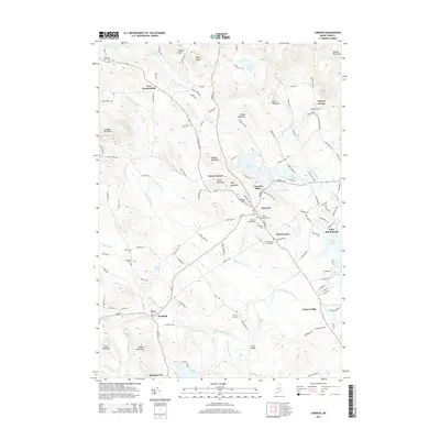
2014 Map of Limerick
USGS Topo · Published 2014About this map
The Little Ossipee River defines the southern reach of this Maine landscape, flowing past industrial vestiges at Ossipee Mills and Limerick Mills. In the early 21st century, the area maintains a pattern of clustered rural settlements like Felch Corner and Perrys Corner, while the eastern edge is dominated by the sprawling waters of Lake Arrowhead. The map provides significant genealogical data through several family-named burial grounds, including the Dearborn Foss Cem, Thompson Cem, and the Day Cem near the riverbanks.
Find a feature on this map
134 named features on this map. Tap any name to fly to it.
Don’t see what you’re looking for? This feature index may not catch every label — zoom into the map to look around manually.
Map Details
Editions of this 2014 Limerick Map
This is the sole edition of this map. No revisions or reprints were ever made.
Other maps of this area

1891 · Buxton
USGS Topo · 1:62,500

1891 · Newfield
USGS Topo · 1:62,500

1892 · Buxton
USGS Topo · 1:62,500

1893 · Buxton
USGS Topo · 1:62,500

1893 · Newfield
USGS Topo · 1:62,500

1896 · Sebago
USGS Topo · 1:62,500

1910 · Kezar Falls
USGS Topo · 1:48,000

1911 · Kezar Falls
USGS Topo · 1:62,500

1933 · Newfield
USGS Topo · 1:48,000

1937 · Newfield
USGS Topo · 1:62,500