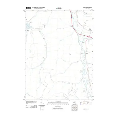
2010 Map of Limestone
USGS Topo · Published 2010About this map
Tunungwant Creek meanders north through a broad valley to its confluence with the Allegheny River, anchoring the eastern corridor of this 2010 topographic survey. The landscape is defined by the sharp contrast between the settled valley floors and the heavily forested highlands of Allegany State Park to the west. Small communities such as Limestone, Irvine Mills, and South Carrollton line the transportation routes following the water, while the interior hills remain largely undeveloped except for recreational sites like Camp Arrowhead and Camp Carleton. Unique geological features like Thunder Rocks and the various hollows, including Stoddard Hollow and Miller Hollow, illustrate the dissected nature of the plateau. The map also traces the legacy of early industry and access through names like Oil Lease Rd and the proximity of Bradford Junction near the southern border.
Find a feature on this map
56 named features on this map. Tap any name to fly to it.
Don’t see what you’re looking for? This feature index may not catch every label — zoom into the map to look around manually.
Map Details
Editions of this 2010 Limestone Map
This is the sole edition of this map. No revisions or reprints were ever made.
Other maps of this area

1900 · Salamanca
USGS Topo · 1:62,500

1922 · Randolph
USGS Topo · 1:62,500

1923 · Randolph
USGS Topo · 1:62,500

1924 · Bradford
USGS Topo · 1:62,500

1926 · Bradford
USGS Topo · 1:62,500

1936 · Kinzua
USGS Topo · 1:48,000

1938 · Salamanca
USGS Topo · 1:62,500

1941 · Kinzua
USGS Topo · 1:62,500

1941 · Bradford
USGS Topo · 1:62,500

1943 · Randolph
USGS Topo · 1:62,500
Featured Places
- Carrollton, NY
- Limestone, Carrollton
- Red House, NY
- Bradford Junction, Carrollton
- Irvine Mills, Carrollton