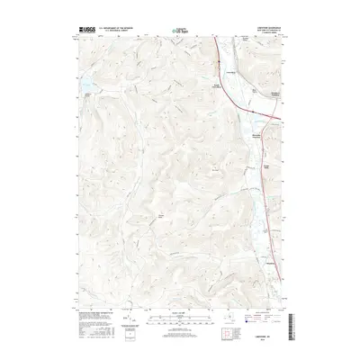
2016 Map of Limestone
USGS Topo · Published 2016About this map
The Allegheny River and Tunuanguant Creek define the eastern valleys of this Southern Tier landscape, where small hamlets like Limestone and Irvine Mills sit at the base of rising ridges. The area is characterized by significant topographic relief, featuring prominent heights such as Mt Irvine and the distinctive Thunder Rocks formations. Much of the western portion of the map is dominated by the forested slopes and winding forest roads of Allegany State Park, including Red House Lake and numerous drainage hollows like Stoddard Hollow. Local history is preserved at the Limestone Cemetery and along the various rail and road junctions that historically served the timber and petroleum interests of Cattaraugus County. The network of "Old" routes, such as Old US Rte 219, suggests the evolution of regional transit through the valley over time.
Find a feature on this map
63 named features on this map. Tap any name to fly to it.
Don’t see what you’re looking for? This feature index may not catch every label — zoom into the map to look around manually.
Map Details
Editions of this 2016 Limestone Map
This is the sole edition of this map. No revisions or reprints were ever made.
Other maps of this area

1900 · Salamanca
USGS Topo · 1:62,500

1922 · Randolph
USGS Topo · 1:62,500

1923 · Randolph
USGS Topo · 1:62,500

1924 · Bradford
USGS Topo · 1:62,500

1926 · Bradford
USGS Topo · 1:62,500

1936 · Kinzua
USGS Topo · 1:48,000

1938 · Salamanca
USGS Topo · 1:62,500

1941 · Kinzua
USGS Topo · 1:62,500

1941 · Bradford
USGS Topo · 1:62,500

1943 · Randolph
USGS Topo · 1:62,500
Featured Places
- Carrollton, NY
- Limestone, Carrollton
- Red House, NY
- Bradford Junction, Carrollton
- Irvine Mills, Carrollton