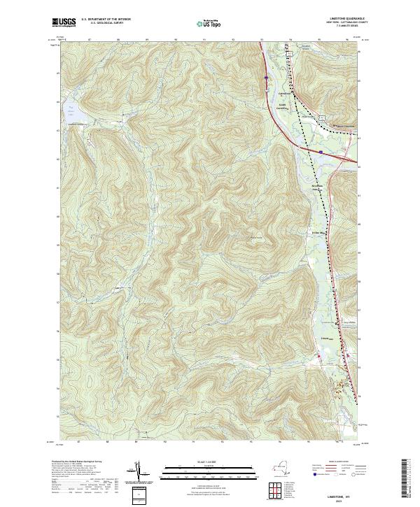
2023 Map of Limestone
USGS Topo · Published 2023About this map
Allegany State Park dominates the western half of this landscape, characterized by a dense network of hollows and ridges such as Mount Irvine and Stoddard Hollow. The park is carved by numerous waterways including Red House Brook and Beehunter Creek, with Red House Lake serving as a central landmark accessible via ASP Rte 1. To the east, the Allegheny River and Tunuangwant Creek valleys define the settlement patterns, where transport corridors like Old US Rte 219 connect the village of Limestone with northern hamlets.
Find a feature on this map
58 named features on this map. Tap any name to fly to it.
Don’t see what you’re looking for? This feature index may not catch every label — zoom into the map to look around manually.
Map Details
Editions of this 2023 Limestone Map
This is the sole edition of this map. No revisions or reprints were ever made.
Other maps of this area

1900 · Salamanca
USGS Topo · 1:62,500

1922 · Randolph
USGS Topo · 1:62,500

1923 · Randolph
USGS Topo · 1:62,500

1924 · Bradford
USGS Topo · 1:62,500

1926 · Bradford
USGS Topo · 1:62,500

1936 · Kinzua
USGS Topo · 1:48,000

1938 · Salamanca
USGS Topo · 1:62,500

1941 · Kinzua
USGS Topo · 1:62,500

1941 · Bradford
USGS Topo · 1:62,500

1943 · Randolph
USGS Topo · 1:62,500
Featured Places
- Carrollton, NY
- Limestone, Carrollton
- Red House, NY
- Bradford Junction, Carrollton
- Irvine Mills, Carrollton