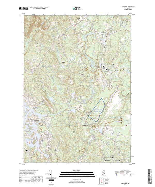
2024 Map of Limington
USGS Topo · Published 2024About this map
The Little Ossipee River and Saco River define the local landscape of York County, Maine, carving through a region characterized by family-named ridges and scattered residential clusters. This area, encompassing Limington, North Hollis, and West Hollis, reveals a deep connection to local lineage through its high density of family cemeteries. Smaller burial grounds such as the Boulter John Cem, George Dresser Cem, and Issac York Cem are found throughout the countryside. The southern portion is dominated by Lake Arrowhead and the NG Hollis Plains Training Site, which occupies a large stretch of terrain east of Isinglass Hill. To the north, Libby Mtn and Moloy Mtn rise above the river valleys, while historic land designations like the Brackett Lot and Dominicus Hasty Lot mark specific parcels of local significance.
Find a feature on this map
145 named features on this map. Tap any name to fly to it.
Don’t see what you’re looking for? This feature index may not catch every label — zoom into the map to look around manually.
Map Details
Editions of this 2024 Limington Map
This is the sole edition of this map. No revisions or reprints were ever made.
Other maps of this area

1891 · Buxton
USGS Topo · 1:62,500

1891 · Newfield
USGS Topo · 1:62,500

1892 · Buxton
USGS Topo · 1:62,500

1893 · Buxton
USGS Topo · 1:62,500

1893 · Newfield
USGS Topo · 1:62,500

1896 · Sebago
USGS Topo · 1:62,500

1910 · Kezar Falls
USGS Topo · 1:48,000

1911 · Kezar Falls
USGS Topo · 1:62,500

1933 · Newfield
USGS Topo · 1:48,000

1937 · Newfield
USGS Topo · 1:62,500