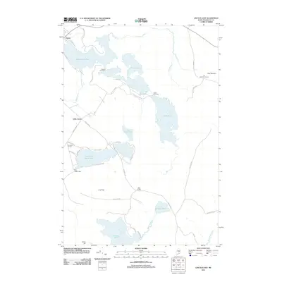
2011 Map of Lincoln East
USGS Topo · Published 2011About this map
The town of Lincoln and the rural crossroads of Libby Corner anchor this landscape defined by an interconnected network of water bodies and ridges. Large glacial ponds like Mattanawcook Pond, Folsom Pond, and Upper Pond dominate the northern and central sections, regulated by structures such as the Folsom Pond Dam and Upper Pond Dam. This hydrography suggests a history of timber management and local water power typical of the Penobscot County interior.
Find a feature on this map
51 named features on this map. Tap any name to fly to it.
Don’t see what you’re looking for? This feature index may not catch every label — zoom into the map to look around manually.
Map Details
Editions of this 2011 Lincoln East Map
This is the sole edition of this map. No revisions or reprints were ever made.
Other maps of this area

1917 · Passadumkeag
USGS Topo · 1:62,500

1920 · Winn
USGS Topo · 1:62,500

1931 · Saponac
USGS Topo · 1:48,000

1934 · Saponac
USGS Topo · 1:62,500

1942 · Lincoln
USGS Topo · 1:62,500

1954 · Millinocket
USGS Topo · 1:250,000

1957 · Lincoln
USGS Topo · 1:62,500

1957 · Saponac
USGS Topo · 1:62,500

1958 · Millinocket
USGS Topo · 1:250,000

1960 · Millinocket
USGS Topo · 1:250,000