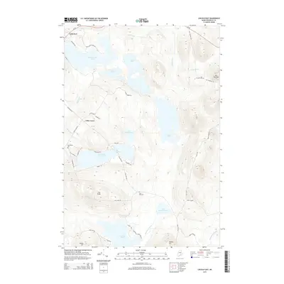
2014 Map of Lincoln East
USGS Topo · Published 2014About this map
The town of Lincoln and its southeastern neighbors are defined by a complex network of glacial ponds and ridges in this Penobscot County landscape. The terrain rises from the shores of Mattanawcook Pond to prominent landmarks like Long Ridge and Dow Mountain. This survey illustrates the 21st-century residential patterns along White Point Estates Rd and Lakeside Dr, contrasting with the more isolated, forested reaches near Little Eskutassis Pond. Genealogists will find significant local history at the Long Ridge Cem, Half Township Cem, and Transalpine Cem. The map provides a detailed look at the drainage patterns of Dead Stream and Eskutassis Stream, showing how water moves through this part of Maine toward the Upper Cold Stream Ponds.
Find a feature on this map
52 named features on this map. Tap any name to fly to it.
Don’t see what you’re looking for? This feature index may not catch every label — zoom into the map to look around manually.
Map Details
Editions of this 2014 Lincoln East Map
This is the sole edition of this map. No revisions or reprints were ever made.
Other maps of this area

1917 · Passadumkeag
USGS Topo · 1:62,500

1920 · Winn
USGS Topo · 1:62,500

1931 · Saponac
USGS Topo · 1:48,000

1934 · Saponac
USGS Topo · 1:62,500

1942 · Lincoln
USGS Topo · 1:62,500

1954 · Millinocket
USGS Topo · 1:250,000

1957 · Lincoln
USGS Topo · 1:62,500

1957 · Saponac
USGS Topo · 1:62,500

1958 · Millinocket
USGS Topo · 1:250,000

1960 · Millinocket
USGS Topo · 1:250,000