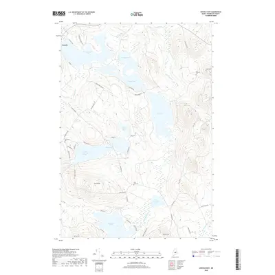
2018 Map of Lincoln East
USGS Topo · Published 2018About this map
The town of Lincoln serves as the gateway to a dense network of water bodies and ridges in this portion of Penobscot County. The landscape is defined by the significant reach of Mattanawcook Pond to the northwest and the sprawling Upper Cold Stream Ponds toward the southwest, connected by a web of brooks and streams including Smelt Brook and Eskutassis Stream. This map reveals a transition from the structured residential roads like White Point Estates Rd and Weatherbee Point Rd to the more rural logging and fire roads that penetrate the interior.
Find a feature on this map
53 named features on this map. Tap any name to fly to it.
Don’t see what you’re looking for? This feature index may not catch every label — zoom into the map to look around manually.
Map Details
Editions of this 2018 Lincoln East Map
This is the sole edition of this map. No revisions or reprints were ever made.
Other maps of this area

1917 · Passadumkeag
USGS Topo · 1:62,500

1920 · Winn
USGS Topo · 1:62,500

1931 · Saponac
USGS Topo · 1:48,000

1934 · Saponac
USGS Topo · 1:62,500

1942 · Lincoln
USGS Topo · 1:62,500

1954 · Millinocket
USGS Topo · 1:250,000

1957 · Lincoln
USGS Topo · 1:62,500

1957 · Saponac
USGS Topo · 1:62,500

1958 · Millinocket
USGS Topo · 1:250,000

1960 · Millinocket
USGS Topo · 1:250,000