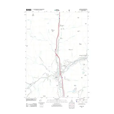
2012 Map of Lincoln
USGS Topo · Published 2012About this map
Lincoln and North Woodstock anchor this mountain corridor where the Pemigewasset River cuts through the high peaks of Grafton County. By the early 21st century, the landscape reflects a mature recreation economy, dominated by the Loon Mountain Ski Area and The Village of Loon Mountain. The town layout in Lincoln shows a dense network of residential streets like Maple St and School St near the Post Office, while the surrounding terrain is marked by significant landmarks such as The Flume and The Basin. Evidence of early transit and river crossings remains in the naming of the Sentinel Pine Bridge, Whitehouse Bridge, and Flume Bridge. To the south, Fairview and the Riverside Cem sit near the confluence of Moosilauke Brook and the river, while the higher elevations feature remote outposts like the Eliza Brook Shelter along the western slopes of South Peak Kinsman Mountain.
Find a feature on this map
92 named features on this map. Tap any name to fly to it.
Don’t see what you’re looking for? This feature index may not catch every label — zoom into the map to look around manually.
Map Details
Editions of this 2012 Lincoln Map
This is the sole edition of this map. No revisions or reprints were ever made.
Other maps of this area

1928 · Plymouth
USGS Topo · 1:62,500

1928 · Rumney
USGS Topo · 1:62,500

1929 · Moosilauke
USGS Topo · 1:62,500

1929 · Franconia
USGS Topo · 1:62,500

1931 · Plymouth
USGS Topo · 1:62,500

1932 · Franconia
USGS Topo · 1:62,500

1932 · Rumney
USGS Topo · 1:62,500

1932 · Moosilauke
USGS Topo · 1:62,500

1949 · Portland
USGS Topo · 1:250,000

1950 · Lewiston
USGS Topo · 1:250,000