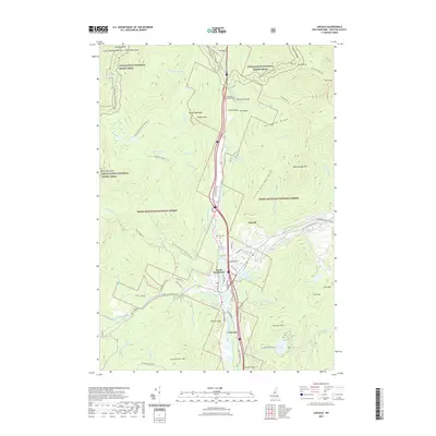
2021 Map of Lincoln
USGS Topo · Published 2021About this map
The Pemigewasset River and its East Branch serve as the central corridor for this 2021 survey of the White Mountains, where the village of Lincoln and the settlement of North Woodstock meet near the intersection of the Appalachian National Scenic Trail and local transportation routes. The landscape is defined by the high-elevation ridges of Franconia Ridge, featuring prominent peaks such as Mt Liberty and Mt Flume.
Find a feature on this map
98 named features on this map. Tap any name to fly to it.
Don’t see what you’re looking for? This feature index may not catch every label — zoom into the map to look around manually.
Map Details
Editions of this 2021 Lincoln Map
This is the sole edition of this map. No revisions or reprints were ever made.
Other maps of this area

1928 · Plymouth
USGS Topo · 1:62,500

1928 · Rumney
USGS Topo · 1:62,500

1929 · Moosilauke
USGS Topo · 1:62,500

1929 · Franconia
USGS Topo · 1:62,500

1931 · Plymouth
USGS Topo · 1:62,500

1932 · Franconia
USGS Topo · 1:62,500

1932 · Rumney
USGS Topo · 1:62,500

1932 · Moosilauke
USGS Topo · 1:62,500

1949 · Portland
USGS Topo · 1:250,000

1950 · Lewiston
USGS Topo · 1:250,000