Loading...
Loading map...2022 Map of Lincoln
USGS Topo · Published 2022About this map
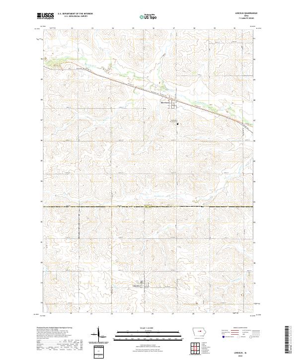
The town of Lincoln sits at the southern edge of this Central Iowa landscape, where the county line separates Grundy and Tama counties. This region is defined by a systematic agricultural grid and a series of westward-flowing waterways, including Black Hawk Cr and Mosquito Cr. The northern portion of the map is dominated by the settlement of Morrison and the prominent diagonal passage of the Pioneer Trl, which follows the Diagonal Rd corridor across the township lines.
Find a feature on this map
28 named features on this map. Tap any name to fly to it.
Don’t see what you’re looking for? This feature index may not catch every label — zoom into the map to look around manually.
Map Details
Date Portrayed2022
Date Published2022
PublisherU.S. Geological Survey
Map TypeTopographic
Scale1:24000
Physical Dimensions24 x 29 inches
Editions of this 2022 Lincoln Map
This is the sole edition of this map. No revisions or reprints were ever made.
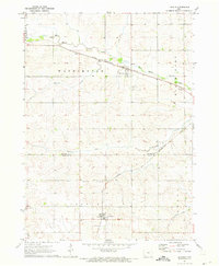
Historical Maps of Morrison Through Time
Featured Locations
Source Details
SourceU.S. Geological Survey
CopyrightPublic Domain