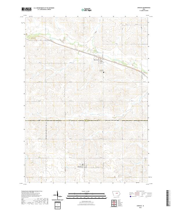
2022 Map of Lincoln
USGS Topo · Published 2022About this map
The town of Lincoln sits at the southern edge of this Central Iowa landscape, where the county line separates Grundy and Tama counties. This region is defined by a systematic agricultural grid and a series of westward-flowing waterways, including Black Hawk Cr and Mosquito Cr. The northern portion of the map is dominated by the settlement of Morrison and the prominent diagonal passage of the Pioneer Trl, which follows the Diagonal Rd corridor across the township lines.
Find a feature on this map
28 named features on this map. Tap any name to fly to it.
Don’t see what you’re looking for? This feature index may not catch every label — zoom into the map to look around manually.
Map Details
Editions of this 2022 Lincoln Map
This is the sole edition of this map. No revisions or reprints were ever made.
Other maps of this area

1954 · Waterloo
USGS Topo · 1:250,000

1955 · Waterloo
USGS Topo · 1:250,000

1960 · Marshalltown
USGS Topo · 1:62,500

1960 · Conrad East
USGS Topo · 1:24,000

1971 · Gladbrook NE
USGS Topo · 1:24,000

1971 · Zaneta
USGS Topo · 1:24,000

1971 · Dike
USGS Topo · 1:24,000

1971 · Lincoln
USGS Topo · 1:24,000

1971 · Reinbeck
USGS Topo · 1:24,000
1971 · Gladbrook
USGS Topo · 1:24,000