
1971 Map of Gladbrook NE
USGS Topo · Published 1973About this map
Wolf Creek meanders across this rural Tama County landscape, carving a wide valley floor through the township boundaries of Grant, Buckingham, Crystal, and Perry. The settlement of Dinsdale serves as the primary rail point along the Chicago and North Western line, which cuts diagonally across the northern portion of the sheet. This early 1970s survey documents a landscape defined by its watercourses and agricultural divisions, from the northern reach of Twelvemile Creek to the southern drainage of Salt Creek. Genealogy researchers will find several well-established burial grounds, including Dinsdale Cem, Crystal Cem, and Bakers Grove Cem, each situated near the section lines that organized this farming country. A Gaging Station located along the creek banks highlights the ongoing management of the region's vital water resources during this era.
Find a feature on this map
14 named features on this map. Tap any name to fly to it.
Don’t see what you’re looking for? This feature index may not catch every label — zoom into the map to look around manually.
Map Details
Editions of this 1971 Gladbrook NE Map
2 editions found
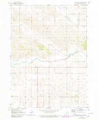
Other maps of this area

1954 · Waterloo
USGS Topo · 1:250,000

1955 · Waterloo
USGS Topo · 1:250,000

1963 · Buckingham
USGS Topo · 1:24,000

1971 · Lincoln
USGS Topo · 1:24,000

1971 · Traer
USGS Topo · 1:24,000
1971 · Clutier
USGS Topo · 1:24,000

1971 · Reinbeck
USGS Topo · 1:24,000

1971 · Garwin
USGS Topo · 1:24,000
1971 · Gladbrook SE
USGS Topo · 1:24,000
1971 · Gladbrook
USGS Topo · 1:24,000