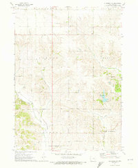
1971 Map of Gladbrook SE
USGS Topo · Published 1973About this map
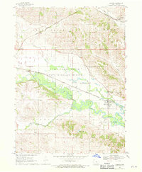
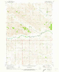
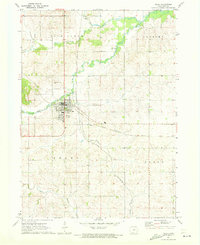
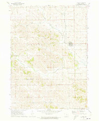
County Home serves as a notable landmark in this central Iowa landscape, positioned among the townships of Howard, Carroll, and Toledo. The terrain is defined by a dense network of waterways including the South Branch Salt Creek and Deer Creek, which drain the agricultural uplands. Evidence of early community centers is preserved in the locations of the Pleasant Hill Ch and Rose Hill Ch, alongside the Fee Chapel Cem. These small rural institutions, often established by early settlers, provide critical anchor points for genealogical research. Transportation and infrastructure are represented by the Chicago and North Western rail line and a local Substation. The eastern portion of the sheet is highlighted by Tama County Lake Park, a significant local recreational area that contrasts with the surrounding agricultural grid.
Find a feature on this map
22 named features on this map. Tap any name to fly to it.
Don’t see what you’re looking for? This feature index may not catch every label — zoom into the map to look around manually.
Map Details
Editions of this 1971 Gladbrook SE Map
This is the sole edition of this map. No revisions or reprints were ever made.
Other maps of this area

1954 · Waterloo
USGS Topo · 1:250,000

1954 · Des Moines
USGS Topo · 1:250,000

1955 · Waterloo
USGS Topo · 1:250,000

1956 · Des Moines
USGS Topo · 1:250,000

1957 · Des Moines
USGS Topo · 1:250,000
1968 · Chelsea
USGS Topo · 1:24,000

1969 · Des Moines
USGS Topo · 1:250,000
1971 · Gladbrook NE
USGS Topo · 1:24,000
1971 · Traer
USGS Topo · 1:24,000
1971 · Clutier
USGS Topo · 1:24,000