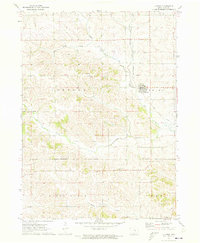
1971 Map of Clutier
USGS Topo · Published 1973About this map
Clutier sits at the intersection of rural townships in Tama County, serving as the primary hub for this agricultural landscape during the early 1970s. The town's connection to the wider region is defined by the Chicago and North Western line, while an old railroad grade further south traces the evolution of transportation in the area. The landscape is deeply carved by water, with Salt Creek, Kibbe Creek, and the South Branch Salt Creek creating a complex network of drainage across the rolling farmland. Local heritage is evident in the numerous religious and burial sites, including St Wenceslaus Ch and Holy Trinity Cem, which speak to the central role of these institutions in the lives of the farming families in Carroll and Oneida townships.
Find a feature on this map
21 named features on this map. Tap any name to fly to it.
Don’t see what you’re looking for? This feature index may not catch every label — zoom into the map to look around manually.
Map Details
Editions of this 1971 Clutier Map
This is the sole edition of this map. No revisions or reprints were ever made.
Other maps of this area

1954 · Waterloo
USGS Topo · 1:250,000

1954 · Des Moines
USGS Topo · 1:250,000

1955 · Waterloo
USGS Topo · 1:250,000

1956 · Des Moines
USGS Topo · 1:250,000

1957 · Des Moines
USGS Topo · 1:250,000

1968 · Belle Plaine
USGS Topo · 1:24,000

1968 · Chelsea
USGS Topo · 1:24,000

1969 · Des Moines
USGS Topo · 1:250,000

1971 · Gladbrook NE
USGS Topo · 1:24,000
1971 · Elberon
USGS Topo · 1:24,000