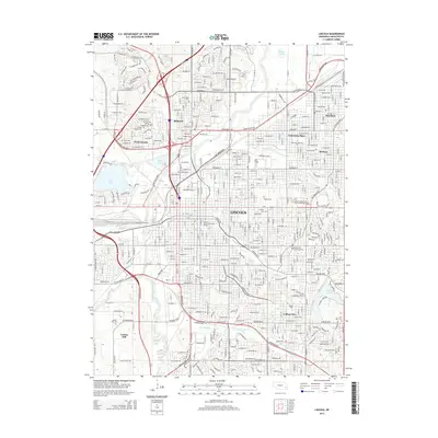
2014 Map of Lincoln
USGS Topo · Published 2014About this map
Lincoln serves as a dense educational and civic hub in this 2014 survey, anchored by the sprawling University of Nebraska-Lincoln and the central Wyuka Cem. The city's growth is characterized by its historical neighborhoods and constituent towns like University Place, Havelock, and College View, each maintaining its distinct identity within the larger grid. Modern transportation arteries such as Rosa Parks Way and the Homestead Expy intersect with the legacy of older routes like the Cornhusker Hwy.
Find a feature on this map
34 named features on this map. Tap any name to fly to it.
Don’t see what you’re looking for? This feature index may not catch every label — zoom into the map to look around manually.
Map Details
Editions of this 2014 Lincoln Map
This is the sole edition of this map. No revisions or reprints were ever made.
Other maps of this area

1897 · Lincoln
USGS Topo · 1:125,000

1955 · Lincoln
USGS Topo · 1:250,000

1957 · Lincoln
USGS Topo · 1:250,000

1958 · Lincoln
USGS Topo · 1:250,000

1964 · Waverly
USGS Topo · 1:24,000

1964 · Denton
USGS Topo · 1:24,000

1964 · Roca
USGS Topo · 1:24,000

1964 · Davey
USGS Topo · 1:24,000

1964 · Walton
USGS Topo · 1:24,000
1964 · Emerald
USGS Topo · 1:24,000