
1964 Map of Roca
USGS Topo · Published 1965About this map
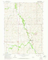
The valley of Salt Creek south of Lincoln serves as a bustling corridor for Nebraska's mid-century rail network, dominated by five distinct lines including the Chicago Rock Island and Pacific and the Missouri Pacific. The village of Roca stands as a focal point near several Quarries, illustrating the local limestone industry that shaped the economy of the Saltillo and Yankee Hill townships. Smaller settlements like Jamaica and Hanlon are tied together by these tracks, while the rural landscape is dotted with centers of community life such as Trinity Chapel and Pioneer Sch. Evidence of early surveying and settlement remains visible through named landmarks like the Saltillo-Simmons Cem. and numerous family-held wells. This mid-1960s study captures the transition of the region as the Hickman Corp Bdy begins to expand and modern light-duty roads alongside Cheyenne Rd replace older trails.
Find a feature on this map
38 named features on this map. Tap any name to fly to it.
Don’t see what you’re looking for? This feature index may not catch every label — zoom into the map to look around manually.
Map Details
Editions of this 1964 Roca Map
2 editions found
Other maps of this area

1897 · Lincoln
USGS Topo · 1:125,000

1955 · Lincoln
USGS Topo · 1:250,000

1957 · Lincoln
USGS Topo · 1:250,000

1958 · Lincoln
USGS Topo · 1:250,000

1964 · Cortland
USGS Topo · 1:24,000
1964 · Hallam
USGS Topo · 1:24,000

1964 · Denton
USGS Topo · 1:24,000

1964 · Walton
USGS Topo · 1:24,000
1964 · Emerald
USGS Topo · 1:24,000
1964 · Lincoln
USGS Topo · 1:24,000