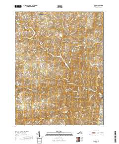
2019 Map of Lincoln
USGS Topo · Published 2019About this map
The Piedmont landscape of Loudoun County is anchored by the settlement of Lincoln, where local history is preserved at the Goose Creek Burying Ground and Mount Olivet Cem. This terrain is defined by a dense network of springs and watercourses, including Telegraph Spring and Silcott Spring, which historically supported the region's agricultural character. Small crossroads communities like Hughesville, Philomont, and North Fork are linked by winding roads that follow the contours of the Culpeper Basin and the valley of North Fork Goose Creek. The presence of the Goose Hunt Farm Airport and several private ponds like the Izaak Walton League Pond reflects the area's modern land use as it evolved from early Virginia farmsteads. The mapping detail shows a mix of traditional landmarks, such as Carters Bridge, alongside more contemporary residential development south of Purcellville.
Find a feature on this map
124 named features on this map. Tap any name to fly to it.
Don’t see what you’re looking for? This feature index may not catch every label — zoom into the map to look around manually.
Map Details
Editions of this 2019 Lincoln Map
This is the sole edition of this map. No revisions or reprints were ever made.
Other maps of this area

1884 · Harpers Ferry
USGS Topo · 1:125,000

1891 · Harpers Ferry
USGS Topo · 1:125,000

1893 · Harpers Ferry
USGS Topo · 1:125,000

1894 · Warrenton
USGS Topo · 1:125,000

1916 · Berryville
USGS Topo · 1:62,500

1933 · Middleburg
USGS Topo · 1:62,500

1939 · Berryville
USGS Topo · 1:48,000

1943 · Arcola
USGS Topo · 1:24,000

1943 · Bluemont
USGS Topo · 1:24,000

1943 · Rectortown
USGS Topo · 1:24,000