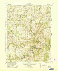
1944 Map of Lincoln
USGS Topo · Published 1944About this map
Goose Creek winds through this 1940s landscape, serving as a primary geographic anchor for the rural communities of Loudoun County. The terrain is defined by its agricultural and industrial character, where crossings like Guinea Bridge and Carters Bridge connect small crossroad settlements such as Philomont, Lincoln, and Oatlands. Local education and faith are central to the map's layout, evidenced by the presence of Woodburn School and Zion Church.
Find a feature on this map
20 named features on this map. Tap any name to fly to it.
Don’t see what you’re looking for? This feature index may not catch every label — zoom into the map to look around manually.
Map Details
Editions of this 1944 Lincoln Map
This is the sole edition of this map. No revisions or reprints were ever made.
Other maps of this area

1884 · Harpers Ferry
USGS Topo · 1:125,000

1891 · Harpers Ferry
USGS Topo · 1:125,000

1893 · Harpers Ferry
USGS Topo · 1:125,000

1894 · Warrenton
USGS Topo · 1:125,000

1916 · Berryville
USGS Topo · 1:62,500

1933 · Middleburg
USGS Topo · 1:62,500

1939 · Berryville
USGS Topo · 1:48,000

1943 · Arcola
USGS Topo · 1:24,000

1943 · Bluemont
USGS Topo · 1:24,000

1943 · Rectortown
USGS Topo · 1:24,000